
More Critical Than Ever. Harder than Ever to Get
Physical AI, autonomy, and every system that moves through the world runs on knowing where it is. M-GPS® reads a signal that's already everywhere, Earth's magnetic field, so position holds where the usual signals thin out.

Everything Needs It
Robots, drones, vehicles and phones all act on location. M-GPS® works on what already moves: the sensors are on board, so it arrives as software, not a retrofit.
Harder to Obtain
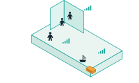
Indoors, underground, downtown and at sea, radio signals thin out. Earth's magnetic field doesn't. M-GPS® isn't limited by walls or ground, so position holds where it used to drop.

Infrastructure Doesn't Scale
Beacons and ground stations cost money and only cover where they're installed. M-GPS® scales like software: nothing to buy or maintain, and the next site is a data update, not a build-out.
Industries We Serve
Turn every aisle into a findable location.
Shoppers get turn-by-turn guidance to the exact shelf. Retailers get aisle-level promotions and real shopper-path analytics — running on the phones customers already carry, with nothing installed in the store.

Know where your people and equipment are when it matters most.
Real-time location for beds, pumps, and wheelchairs. Wayfinding across sprawling campuses. Staff location during a code. Knowing where your people are shouldn't come with a six-figure infrastructure bill attached.

Location that follows the asset, not the network.
Warehouse-wide positioning for workers, forklifts, and autonomous robots, plus inventory location down to the rack. Coverage holds through steel-clad buildings and container yards where signal-based systems fail.

Positioning that survives the tunnel and the parking structure.
Continuous vehicle location through tunnels, urban canyons, and multi-level garages where GNSS goes dark. Supports last-mile routing, EV charging navigation, and the sensor redundancy autonomous stacks require.

Location where signals were never designed to reach.
Positioning for crews and equipment across refineries, mines, tunnels, and underground utilities. Track people through steel, concrete, and earth — no repeaters, no leaky feeder, no line of sight.

The floor matters. So does the room.
Vertical and horizontal location for 911 callers and responders inside multi-story buildings, and team positioning during search and rescue where GPS returns a street address and nothing more.

Other location systems ask you to build or buy infrastructure.
BLE beacons, Wi-Fi RTT, and UWB anchors all work the same way. Install hardware throughout the building, survey the space, calibrate the network against known reference points, then keep maintaining all of it. Coverage stops at the edge of what you paid to install, and it degrades quietly as batteries drain and anchors drift out of alignment. Every new floor, warehouse, or campus restarts the cycle — another quote, another install window, another line in the capital budget.
M-GPS® starts from a signal that's already there. Our ML models convert the Earth's geomagnetic signatures into precise XYZ location data using the magnetometer already built into billions of phones, vehicles, and edge devices. Because it's non-spectrum and non-RF, there's nothing to license, nothing to jam, and nothing to install. It's delivered as an SDK that integrates into the systems you're already running, and it works the same way across land, sea, air, indoors, and underground — backed by ten patents and more than a decade of real-world training data.

Zero Hardware Cost
No beacons, no anchors, no access points. M-GPS® runs on the magnetometer already inside the devices your people and customers carry.

Fast to Deploy
An SDK integration and a walkthrough survey to map the space — no ceiling work, no contractor scheduling before you see location data.

Low Maintenance
No batteries to swap, no anchors drifting out of alignment. When a space changes, the map is refreshed in software — not with a truck roll.

Sub-Meter Accuracy
Precision indoors and underground, including the z-axis — so you get the floor and the room, not just the building's footprint.

Uncapped Scalability
Cost isn't tied to hardware per square foot. Adding a floor, a building, or a hundred sites is a software rollout and a survey, not another capex cycle.

"What's going on in Ukraine — what's going on in the Gulf — is a GPS-denied environment, essentially jamming communications and GPS. You can't target weapon systems, you can't navigate... you're going to need other forms of technology like AstraNav..."

"This integration represents a significant step forward in mobile staff safety. By leveraging AstraNav's geomagnetic positioning capabilities within our staff safety mobile app, we can deliver indoor location functionality without deploying additional infrastructure — making safety more accessible, scalable, and cost-effective for healthcare organizations."
.png?width=1200&height=1200&name=Naval_Special_Warfare_Center%20(1).png)
"All of our PNT devices should have this software in them.”

“Swiftly is leveraging AstraNav’s capabilities to enable shoppers to efficiently locate the products they are looking for, unlock personalized promotions and coupons that are specific to the aisle they’re shopping, and ultimately save them time and money, all with zero extra capital investments from our retail partners.”
"This application needs to be integrated into the TAK environment for immediate use, or with any hardware that already employs a magnetometer.”
“AstraNav’s infrastructure-free M-GPS tech worked as soon as users entered the store to give sub-meter accuracy navigation and turn-by-turn directions to any items in the store on their smartphones.”
“The M-GPS software application appears very mature and clearly provides a reliable source of navigation information in GPS-denied environments.”
.png?width=400&height=283&name=image%20(10).png)
"At Virginia Tech, we were able to easily integrate M-GPS with commercial off-the shelf (COTS) autonomous vehicles to achieve sub-meter accuracy positioning, even indoors. AstraNav M-GPS can achieve accurate, efficient, and resilient sub-meter positioning and has the potential to be a completely ‘plug-and-play’ technology for consumers over a wide range of applications and in all domains.”